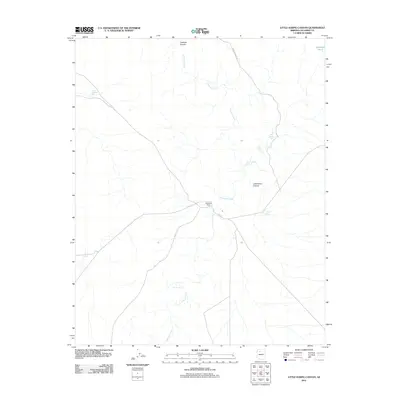
2011 Map of Little Harpo Canyon
USGS Topo · Published 2011About this map
Redlands Ranch sits at a remote crossroads in the high desert of Coconino County, serving as a primary point of human activity in this arid landscape. The area is defined by the significant drainage of Cataract Creek, which winds through the expansive Cataract Canyon and its smaller tributary, Little Harpo Canyon.
Find a feature on this map
13 named features on this map. Tap any name to fly to it.
Don’t see what you’re looking for? This feature index may not catch every label — zoom into the map to look around manually.
Map Details
Editions of this 2011 Little Harpo Canyon Map
This is the sole edition of this map. No revisions or reprints were ever made.
Other maps of this area

1886 · Chino
USGS Topo · 1:250,000

1891 · Chino
USGS Topo · 1:250,000

1948 · Williams
USGS Topo · 1:250,000

1954 · Williams
USGS Topo · 1:250,000

1956 · Williams
USGS Topo · 1:250,000

1960 · Williams
USGS Topo · 1:250,000

1961 · Williams
USGS Topo · 1:250,000
1979 · Box K Ranch
USGS Topo · 1:24,000

1979 · Little Harpo Canyon
USGS Topo · 1:24,000
1979 · Metzger Tank
USGS Topo · 1:24,000