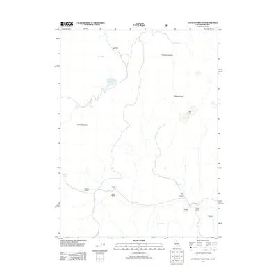
2012 Map of Little Hat Mountain
USGS Topo · Published 2012About this map
Little Hat Mountain dominates the western portion of this high-desert landscape in Washoe County, where volcanic history is written into the terrain through features like the Lava Slides south of Newland Meadows. The map reveals a sparse but vital network of water sources and ranching outposts, including Newland Reservoir and several natural springs such as Runyon Springs and Orchard Spring. Evidence of human activity is concentrated along Tuledad Rd, which snakes through Tuledad Canyon and the Upper Tuledad Valley. This area represents a quiet segment of the Great Basin, where named locations like Old Marr Ranch and Old Millsap Ranch indicate established land use in a region defined by steep canyons and prominent peaks like Mahogany Mountain.
Find a feature on this map
22 named features on this map. Tap any name to fly to it.
Don’t see what you’re looking for? This feature index may not catch every label — zoom into the map to look around manually.
Map Details
Editions of this 2012 Little Hat Mountain Map
This is the sole edition of this map. No revisions or reprints were ever made.
Other maps of this area

1886 · Alturas
USGS Topo · 1:250,000

1886 · Honey Lake
USGS Topo · 1:250,000

1886 · Granite Range
USGS Topo · 1:250,000

1889 · Long Valley
USGS Topo · 1:250,000

1891 · Honey Lake
USGS Topo · 1:250,000

1892 · Alturas
USGS Topo · 1:250,000

1893 · Honey Lake
USGS Topo · 1:250,000

1894 · Granite Range
USGS Topo · 1:250,000

1954 · Observation Peak
USGS Topo · 1:62,500

1954 · Vya
USGS Topo · 1:250,000