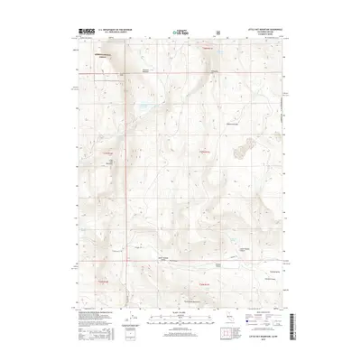
2015 Map of Little Hat Mountain
USGS Topo · Published 2015About this map
Modoc National Forest occupies the northwestern corner of this high-desert landscape, where the Lava Slides and Little Hat Mountain rise above the drainage of Bare Cr. The terrain is defined by a series of distinct upland features, including the Coppersmith Hills and Mahogany Mtn, which overlook the expansive Tuledad Valley. This area represents a critical ranching and grazing corridor near the California-Nevada border, anchored by the presence of vital water sources like Newland Reservoir, Orchard Spring, and Mahogany Springs. In the south, the landscape transitions into the Cottonwood Mountains, where Little Tuledad Canyon and Express Canyon carve through the dry hills. Traces of historical movement through these valleys are preserved in the alignments of Clark's Valley Rd and Tuledad Rd, which provided essential access to remote springs like Runyan Springs.
Find a feature on this map
26 named features on this map. Tap any name to fly to it.
Don’t see what you’re looking for? This feature index may not catch every label — zoom into the map to look around manually.
Map Details
Editions of this 2015 Little Hat Mountain Map
This is the sole edition of this map. No revisions or reprints were ever made.
Other maps of this area

1886 · Alturas
USGS Topo · 1:250,000

1886 · Honey Lake
USGS Topo · 1:250,000

1886 · Granite Range
USGS Topo · 1:250,000

1889 · Long Valley
USGS Topo · 1:250,000

1891 · Honey Lake
USGS Topo · 1:250,000

1892 · Alturas
USGS Topo · 1:250,000

1893 · Honey Lake
USGS Topo · 1:250,000

1894 · Granite Range
USGS Topo · 1:250,000

1954 · Observation Peak
USGS Topo · 1:62,500

1954 · Vya
USGS Topo · 1:250,000