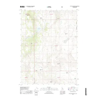
2018 Map of Little Hat Mountain
USGS Topo · Published 2018About this map
Little Hat Mtn and the high ridges of the Cottonwood Mountains dominate this high-desert landscape along the border of California and Nevada. In the northwestern corner, the Modoc National Forest encompasses a dramatic geological area marked by Lava Slides and the open expanse of Newland Meadows. This 2018 survey reveals a terrain defined by its water sources, where numerous springs such as Ant Spring, Mahogany Springs, and Runyon Springs provide vital points of interest in an otherwise arid environment. The map details the drainage patterns of Tuledad Canyon and Little Tuledad Canyon, which feed into the broader Tuledad Valley. For researchers and land-use historians, the presence of the Newland Reservoir and the network of local routes like Red Rock Rd and Tuledad Rd illustrate how this remote borderland has been managed for water and forest access.
Find a feature on this map
33 named features on this map. Tap any name to fly to it.
Don’t see what you’re looking for? This feature index may not catch every label — zoom into the map to look around manually.
Map Details
Editions of this 2018 Little Hat Mountain Map
This is the sole edition of this map. No revisions or reprints were ever made.
Other maps of this area

1886 · Alturas
USGS Topo · 1:250,000

1886 · Honey Lake
USGS Topo · 1:250,000

1886 · Granite Range
USGS Topo · 1:250,000

1889 · Long Valley
USGS Topo · 1:250,000

1891 · Honey Lake
USGS Topo · 1:250,000

1892 · Alturas
USGS Topo · 1:250,000

1893 · Honey Lake
USGS Topo · 1:250,000

1894 · Granite Range
USGS Topo · 1:250,000

1954 · Observation Peak
USGS Topo · 1:62,500

1954 · Vya
USGS Topo · 1:250,000