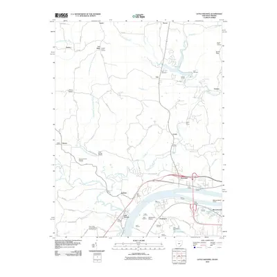
2010 Map of Little Hocking
USGS Topo · Published 2010About this map
Blennerhassett Island sits in the Ohio River at the southeastern edge of this survey, marking a notable point of historical geography where the river forms the border between Ohio and West Virginia. The landscape north of the river is defined by the winding course of the Little Hocking River and its various branches, which reach up toward settlements like Veto and Dunbar. In the river valley, Washington Bottom and Porterfield serve as focal points for local commerce and transport, including river access at Lewis Landing and Goodnoughs Landing.
Find a feature on this map
105 named features on this map. Tap any name to fly to it.
Don’t see what you’re looking for? This feature index may not catch every label — zoom into the map to look around manually.
Map Details
Editions of this 2010 Little Hocking Map
This is the sole edition of this map. No revisions or reprints were ever made.
Other maps of this area

1902 · Parkersburg
USGS Topo · 1:62,500

1904 · Parkersburg
USGS Topo · 1:62,500

1904 · Chesterhill
USGS Topo · 1:62,500

1906 · Belleville
USGS Topo · 1:62,500

1906 · Chesterhill
USGS Topo · 1:62,500

1907 · Keno
USGS Topo · 1:62,500

1924 · Belleville
USGS Topo · 1:62,500

1926 · Belleville
USGS Topo · 1:62,500

1949 · Clarksburg
USGS Topo · 1:250,000

1956 · Clarksburg
USGS Topo · 1:250,000