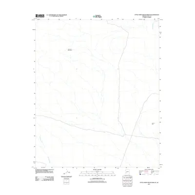
2011 Map of Little Horn Mountains SE
USGS Topo · Published 2011About this map
The Little Horn Mountains dominate the northern landscape of this Yuma County quadrangle, where high desert terrain is defined by complex drainage systems and isolated peaks. This 2011 survey illustrates the arid geography of the Sonoran Desert, showing the varied elevations of the Clanton Hills in the southeast and the intermittent courses of Deadman Wash and Red Raven Wash. Water resources in such a climate are rare, represented here by the small catchment at Deadman Tank near the northeastern corner. The map traces the primitive road network and desert tracks that navigate between these landforms, revealing the sparse human footprint in a region largely shaped by volcanic geology and alluvial activity.
Find a feature on this map
5 named features on this map. Tap any name to fly to it.
Don’t see what you’re looking for? This feature index may not catch every label — zoom into the map to look around manually.
Map Details
Editions of this 2011 Little Horn Mountains SE Map
This is the sole edition of this map. No revisions or reprints were ever made.
Other maps of this area

1927 · Hyder
USGS Topo · 1:62,500

1930 · Hyder
USGS Topo · 1:62,500

1942 · Vicksburg
USGS Topo · 1:250,000

1954 · Phoenix
USGS Topo · 1:250,000

1957 · Phoenix
USGS Topo · 1:250,000

1958 · Phoenix
USGS Topo · 1:250,000

1960 · Phoenix
USGS Topo · 1:250,000

1962 · Little Horn Mts
USGS Topo · 1:62,500

1962 · Eagletail Mts
USGS Topo · 1:62,500
1965 · Palomas Mts
USGS Topo · 1:62,500