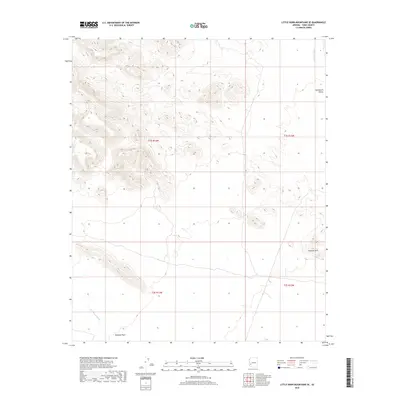
2018 Map of Little Horn Mountains SE
USGS Topo · Published 2018About this map
Palomas Plain extends across the southwestern corner of this desert landscape, where the wide channel of Red Raven Wash cuts through the level ground. The terrain is defined by extreme relief, shifting from these broad basins to the high, broken ridges of the mountains. In the east, the Clanton Hills rise as a distinct topographical landmark, standing apart from the primary range. To the north and east, the Nottbusch Valley provides a significant corridor through the landscape, drained by the seasonal course of Deadman Wash. This 2018 survey by the U.S. Geological Survey documents the region's complex drainage patterns and the stark transition between the valley floors and the elevated outcrops that characterize this portion of Yuma County.
Find a feature on this map
9 named features on this map. Tap any name to fly to it.
Don’t see what you’re looking for? This feature index may not catch every label — zoom into the map to look around manually.
Map Details
Editions of this 2018 Little Horn Mountains SE Map
This is the sole edition of this map. No revisions or reprints were ever made.
Other maps of this area

1927 · Hyder
USGS Topo · 1:62,500

1930 · Hyder
USGS Topo · 1:62,500

1942 · Vicksburg
USGS Topo · 1:250,000

1954 · Phoenix
USGS Topo · 1:250,000

1957 · Phoenix
USGS Topo · 1:250,000

1958 · Phoenix
USGS Topo · 1:250,000

1960 · Phoenix
USGS Topo · 1:250,000

1962 · Little Horn Mts
USGS Topo · 1:62,500

1962 · Eagletail Mts
USGS Topo · 1:62,500
1965 · Palomas Mts
USGS Topo · 1:62,500