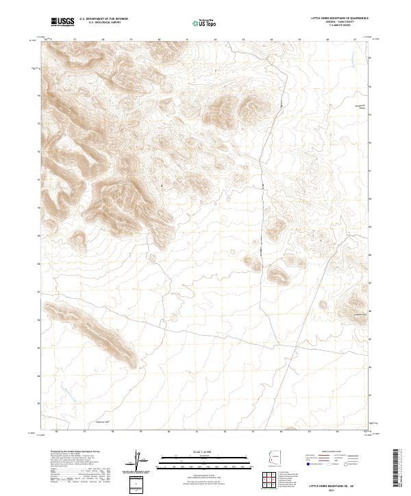
2021 Map of Little Horn Mountains SE
USGS Topo · Published 2021About this map
Palomas Plain dominates the southern landscape of this Arizona quadrangle, illustrating the arid transition between desert flats and the surrounding uplands. The drainage patterns of Deadman Wash in the northeast and Red Raven Wash in the southwest define the movement of water across this Yuma County expanse. The topographic relief is most prominent in the east, where the Clanton Hills rise above the basin floor, and the Nottbusch Valley provides a distinct geographical break in the northeast corner. This map documents a largely undeveloped wilderness within the t15 r13w and t2s r12w townships, showing the land as it exists today without modern encroachment. The sparse infrastructure emphasizes the environmental character of the region, where natural landforms like the Clanton Hills serve as the primary landmarks for those traversing the high desert terrain.
Find a feature on this map
9 named features on this map. Tap any name to fly to it.
Don’t see what you’re looking for? This feature index may not catch every label — zoom into the map to look around manually.
Map Details
Editions of this 2021 Little Horn Mountains SE Map
This is the sole edition of this map. No revisions or reprints were ever made.
Other maps of this area

1927 · Hyder
USGS Topo · 1:62,500

1930 · Hyder
USGS Topo · 1:62,500

1942 · Vicksburg
USGS Topo · 1:250,000

1954 · Phoenix
USGS Topo · 1:250,000

1957 · Phoenix
USGS Topo · 1:250,000

1958 · Phoenix
USGS Topo · 1:250,000

1960 · Phoenix
USGS Topo · 1:250,000

1962 · Little Horn Mts
USGS Topo · 1:62,500

1962 · Eagletail Mts
USGS Topo · 1:62,500
1965 · Palomas Mts
USGS Topo · 1:62,500