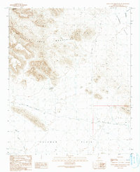
1990 Map of Little Horn Mountains SE
USGS Topo · Published 1990About this map
The Little Horn Mountains dominate this arid landscape in Yuma County, giving way to the broad expanse of the Palomas Plain in the south. This 1990 provisional survey documents a region defined by its desert hydrology and mineral exploration history, with features like Seegmiller Tank and multiple Guzzlers providing critical water points for wildlife and travelers. To the east, the Clanton Hills rise from the desert floor near the head of Nottbusch Valley.
Find a feature on this map
14 named features on this map. Tap any name to fly to it.
Don’t see what you’re looking for? This feature index may not catch every label — zoom into the map to look around manually.
Map Details
Editions of this 1990 Little Horn Mountains SE Map
This is the sole edition of this map. No revisions or reprints were ever made.
Other maps of this area

1927 · Hyder
USGS Topo · 1:62,500

1930 · Hyder
USGS Topo · 1:62,500

1942 · Vicksburg
USGS Topo · 1:250,000

1954 · Phoenix
USGS Topo · 1:250,000

1957 · Phoenix
USGS Topo · 1:250,000

1958 · Phoenix
USGS Topo · 1:250,000

1960 · Phoenix
USGS Topo · 1:250,000

1962 · Little Horn Mts
USGS Topo · 1:62,500

1962 · Eagletail Mts
USGS Topo · 1:62,500
1965 · Palomas Mts
USGS Topo · 1:62,500