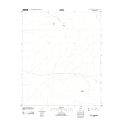
2011 Map of Little Horn Peak
USGS Topo · Published 2011About this map
Big Horn Mountains terrain dominates this Maricopa County landscape, where elevation changes are defined by the arid peaks of the Little Horn Peak and Little Bighorn Peak. The map documents a sparsely developed area of the Arizona desert during the early twenty-first century, characterized by seasonal drainage patterns and a minimalist road network. Pump Mine Wash cuts through the northeast, reflecting the hydrologic character of the region. Transportation is limited to remote corridors including Little Horn Peak Rd and Big Horn Rd, providing access to these high points within the range. The arrangement of these roads suggests their primary use for access to the summits and the remote interior of the mountains, far from any established town centers.
Find a feature on this map
6 named features on this map. Tap any name to fly to it.
Don’t see what you’re looking for? This feature index may not catch every label — zoom into the map to look around manually.
Map Details
Editions of this 2011 Little Horn Peak Map
This is the sole edition of this map. No revisions or reprints were ever made.
Other maps of this area

1942 · Vicksburg
USGS Topo · 1:250,000

1954 · Phoenix
USGS Topo · 1:250,000

1957 · Phoenix
USGS Topo · 1:250,000

1958 · Phoenix
USGS Topo · 1:250,000

1960 · Phoenix
USGS Topo · 1:250,000

1961 · Lone Mountain
USGS Topo · 1:62,500

1961 · Big Horn Mts
USGS Topo · 1:62,500

1961 · Gladden
USGS Topo · 1:62,500
1962 · Aguila
USGS Topo · 1:62,500

1969 · Phoenix
USGS Topo · 1:250,000