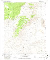
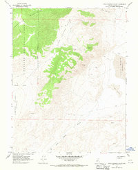
1967 Map of Little Huntoon Valley
USGS Topo · Published 1983About this map
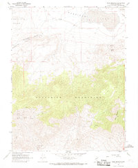
Mining operations and arid landforms define this high-altitude landscape in Nevada's Mineral County as it was documented in the late 1960s. The eastern slopes of the Excelsior Mountains and the western reaches of the Toiyabe National Forest provide the dramatic backdrop for a series of remote mineral claims. Researchers will find several named sites including the Silver Moon Mine, Pine Crow Mine, and Defender Mine, along with various unnamed Prospects scattered across the drainage basins.
Find a feature on this map
16 named features on this map. Tap any name to fly to it.
Don’t see what you’re looking for? This feature index may not catch every label — zoom into the map to look around manually.
Map Details
Editions of this 1967 Little Huntoon Valley Map
2 editions found
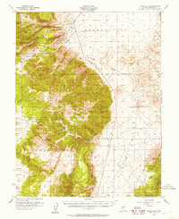
Other maps of this area

1909 · Hawthorne
USGS Topo · 1:250,000

1911 · Hawthorne
USGS Topo · 1:250,000

1915 · Hawthorne
USGS Topo · 1:250,000

1948 · Walker Lake
USGS Topo · 1:250,000
1955 · Powell Mtn
USGS Topo · 1:62,500

1957 · Walker Lake
USGS Topo · 1:250,000
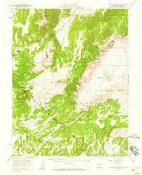
1958 · Huntoon Valley
USGS Topo · 1:62,500

1962 · Walker Lake
USGS Topo · 1:250,000

1964 · Walker Lake
USGS Topo · 1:250,000
1967 · Moho Mountain
USGS Topo · 1:24,000