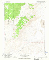
1967 Map of Little Huntoon Valley
USGS Topo · Published 1970About this map
The Excelsior Mountains dominate this high-desert landscape in Mineral County, Nevada, where the eastern slopes descend toward the white alkali crust of the Teels Marsh (Depression). This mid-century survey captures a region defined by remote mineral extraction and severe topography, punctuated by a series of high-altitude mining claims. Prospectors and mining engineers established sites such as the Defender Mine, Silver Moon Mine, and the Pine Crow Mine, all accessible by a network of steep Jeep Trails that traverse the ridges. The western edge of the quadrangle is sheltered within the Toyiabe National Forest, while the lowland areas reveal dramatic geological shifts, from the Sand Dunes near the marsh to the enclosed Little Huntoon Valley. The prevalence of scattered prospects and isolated Springs underscores the challenging conditions for those seeking mineral wealth in this arid terrain.
Find a feature on this map
18 named features on this map. Tap any name to fly to it.
Don’t see what you’re looking for? This feature index may not catch every label — zoom into the map to look around manually.
Map Details
Editions of this 1967 Little Huntoon Valley Map
2 editions found
Other maps of this area

1909 · Hawthorne
USGS Topo · 1:250,000

1911 · Hawthorne
USGS Topo · 1:250,000

1915 · Hawthorne
USGS Topo · 1:250,000

1948 · Walker Lake
USGS Topo · 1:250,000

1955 · Powell Mtn
USGS Topo · 1:62,500

1957 · Walker Lake
USGS Topo · 1:250,000

1958 · Huntoon Valley
USGS Topo · 1:62,500

1962 · Walker Lake
USGS Topo · 1:250,000

1964 · Walker Lake
USGS Topo · 1:250,000

1967 · Moho Mountain
USGS Topo · 1:24,000