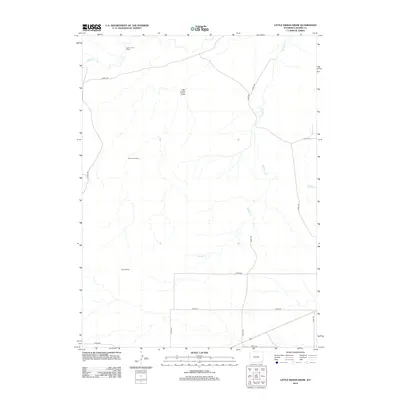
2012 Map of Little Indian Draw
USGS Topo · Published 2012About this map
Little Indian Draw carves through this portion of Laramie County, defining a landscape of high plains drainage and ranching infrastructure. The map reveals a network of remote outposts and utility points, including Little Indian Camp and Divide Camp, which suggest the logistical needs of large-scale land management in the Wyoming interior. Near the northern boundary, the Lower J H D Sheds stand near the banks of Horse Cr, while several branches of Sprager Cr and Middle Cr spider-web across the eastern sections. The presence of Missile Rd cutting across the northern township highlights the Cold War-era military footprint that remains a distinct characteristic of this region's modern geography.
Find a feature on this map
18 named features on this map. Tap any name to fly to it.
Don’t see what you’re looking for? This feature index may not catch every label — zoom into the map to look around manually.
Map Details
Editions of this 2012 Little Indian Draw Map
This is the sole edition of this map. No revisions or reprints were ever made.
Other maps of this area

1899 · Goshen Hole
USGS Topo · 1:125,000

1911 · Cheyenne
USGS Topo · 1:125,000

1914 · Cheyenne
USGS Topo · 1:125,000

1954 · Cheyenne
USGS Topo · 1:250,000

1958 · Cheyenne
USGS Topo · 1:250,000

1960 · Rocky Hollow
USGS Topo · 1:24,000

1963 · Little Indian Draw
USGS Topo · 1:24,000

1963 · Pole Creek Ranch SE
USGS Topo · 1:24,000

1963 · Midway
USGS Topo · 1:24,000

1963 · Midway SW
USGS Topo · 1:24,000