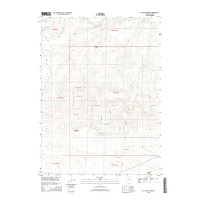
2015 Map of Little Indian Draw
USGS Topo · Published 2015About this map
Little Indian Draw and the surrounding drainage systems of Bullwhacker Draw and Chivington Draw characterize this portion of Laramie County. The landscape is defined by the ephemeral flows of Horse Creek and Sprager Creek, which cut through the high plains. A distinct grid of named rural roads, including Buckhorn Blvd and Bruegman Rd, suggests a pattern of modern land division and ranching tracts across the township boundaries. The naming conventions of the local thoroughfares, such as Billy The Kid Blvd, Barbwire Blvd, and Buckshot Blvd, provide a unique cultural touchpoint for this Wyoming ranching territory. These features together show a sparsely populated but organized region where local geography is tied closely to the network of creeks and private land access.
Find a feature on this map
36 named features on this map. Tap any name to fly to it.
Don’t see what you’re looking for? This feature index may not catch every label — zoom into the map to look around manually.
Map Details
Editions of this 2015 Little Indian Draw Map
This is the sole edition of this map. No revisions or reprints were ever made.
Other maps of this area

1899 · Goshen Hole
USGS Topo · 1:125,000

1911 · Cheyenne
USGS Topo · 1:125,000

1914 · Cheyenne
USGS Topo · 1:125,000

1954 · Cheyenne
USGS Topo · 1:250,000

1958 · Cheyenne
USGS Topo · 1:250,000

1960 · Rocky Hollow
USGS Topo · 1:24,000

1963 · Little Indian Draw
USGS Topo · 1:24,000

1963 · Pole Creek Ranch SE
USGS Topo · 1:24,000

1963 · Midway
USGS Topo · 1:24,000

1963 · Midway SW
USGS Topo · 1:24,000