2023 Map of Little Meadows
USGS Topo · Published 2023About this map
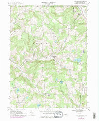
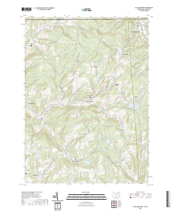
Little Meadows and the surrounding borderlands of the Pennsylvania-New York line are defined by a series of high ridges and narrow valleys. This landscape, shaped by drainage systems like Wappasening Creek and Chaffee Run, supports several small communities including Warren Center, Warrenham, and South Warren. The terrain rises to landmarks like Coburn Hill and Irish Hill, where a network of rural roads such as the Owego-Montrose Tpke connects isolated farmsteads and historic family sites. Genealogy and local history are particularly well-represented through numerous burial grounds, including the Albert Brainard Family Cem and Saint Luke's Cem. Large water bodies like Lake Of Meadows and Highland Lake punctuate the eastern half of the area, illustrating the importance of natural basins in this part of Susquehanna and Bradford counties.
Find a feature on this map
78 named features on this map. Tap any name to fly to it.
Don’t see what you’re looking for? This feature index may not catch every label — zoom into the map to look around manually.
Map Details
Editions of this 2023 Little Meadows Map
This is the sole edition of this map. No revisions or reprints were ever made.