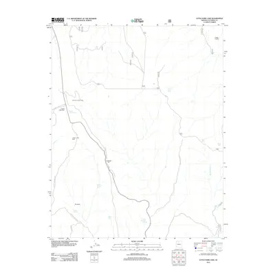
2012 Map of Little Park Lake
USGS Topo · Published 2012About this map
North Rim Lookout Tower stands as a primary landmark in this section of the Kaibab Plateau, overlooking a landscape defined by seasonal water sources and distinct highland parks. The topography is marked by a series of open meadows including Upper Little Park and Lower Little Park, which are connected by a network of specialized access routes like Kanabowits Lookout Tower Rd and the National Park Service Rd. The presence of numerous named springs, such as Robbers Roost Spring, South Canyon Spring, and Basin Spring, suggests a delicate hydrological balance critical for the area's management.
Find a feature on this map
24 named features on this map. Tap any name to fly to it.
Don’t see what you’re looking for? This feature index may not catch every label — zoom into the map to look around manually.
Map Details
Editions of this 2012 Little Park Lake Map
This is the sole edition of this map. No revisions or reprints were ever made.
Other maps of this area

1886 · Echo Cliffs
USGS Topo · 1:250,000

1886 · Kaibab
USGS Topo · 1:250,000

1891 · Echo Cliffs
USGS Topo · 1:250,000

1903 · Bright Angel
USGS Topo · 1:48,000

1906 · Bright Angel
USGS Topo · 1:48,000

1907 · Vishnu
USGS Topo · 1:48,000

1953 · Grand Canyon
USGS Topo · 1:250,000

1954 · Nankoweap
USGS Topo · 1:62,500

1956 · Marble Canyon
USGS Topo · 1:250,000

1957 · Grand Canyon
USGS Topo · 1:250,000