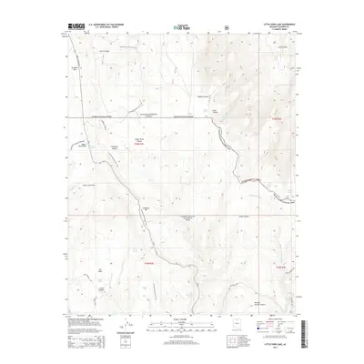
2014 Map of Little Park Lake
USGS Topo · Published 2014About this map
De Motte Park and the high plateau north of the Grand Canyon are the focus of this modern topographic study, where the transition between the Kaibab National Forest and Grand Canyon National Park is clearly defined. The geography is dominated by complex drainage systems and isolated water sources like Robbers Roost Spring, Basin Spring, and the seasonally significant Hades Lake. Central to the area’s recreational and historical connectivity is the Arizona National Scenic Trail, which traverses the landscape past landmarks such as Lindbergh Hill and Upper Little Park.
Find a feature on this map
41 named features on this map. Tap any name to fly to it.
Don’t see what you’re looking for? This feature index may not catch every label — zoom into the map to look around manually.
Map Details
Editions of this 2014 Little Park Lake Map
This is the sole edition of this map. No revisions or reprints were ever made.
Other maps of this area

1886 · Echo Cliffs
USGS Topo · 1:250,000

1886 · Kaibab
USGS Topo · 1:250,000

1891 · Echo Cliffs
USGS Topo · 1:250,000

1903 · Bright Angel
USGS Topo · 1:48,000

1906 · Bright Angel
USGS Topo · 1:48,000

1907 · Vishnu
USGS Topo · 1:48,000

1953 · Grand Canyon
USGS Topo · 1:250,000

1954 · Nankoweap
USGS Topo · 1:62,500

1956 · Marble Canyon
USGS Topo · 1:250,000

1957 · Grand Canyon
USGS Topo · 1:250,000