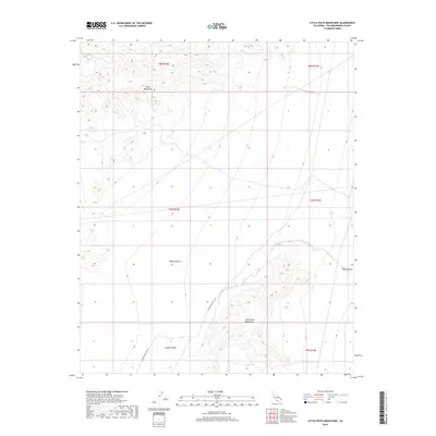
2018 Map of Little Piute Mountains
USGS Topo · Published 2018About this map
Mojave Desert terrain dominates this 2018 survey of eastern San Bernardino County, where the stark topography of the Piute Mountains and the Little Piute Mountains rises above the basin floor. This modern topographic record captures a landscape primarily defined by its drainage patterns and elevation changes rather than human settlement. The most significant historical and recreational corridor present is the E Mojave Heritage Trl, which winds through the southern reaches of the quadrangle. As the land slopes toward the east into Ward Valley, the map illustrates the remote character of this desert region, preserved as public land managed by federal agencies. The survey provides precise details on the land-management grid, including boundaries for t8n r18e and t7n r19e, which are essential for locating specific mining claims or grazing allotments in this arid environment.
Find a feature on this map
11 named features on this map. Tap any name to fly to it.
Don’t see what you’re looking for? This feature index may not catch every label — zoom into the map to look around manually.
Map Details
Editions of this 2018 Little Piute Mountains Map
This is the sole edition of this map. No revisions or reprints were ever made.
Other maps of this area

1942 · Amboy
USGS Topo · 1:250,000

1943 · Center Hills
USGS Topo · 1:62,500

1943 · Amboy
USGS Topo · 1:250,000

1943 · Essex
USGS Topo · 1:62,500

1943 · Fenner
USGS Topo · 1:62,500

1943 · Bannock
USGS Topo · 1:62,500

1954 · Needles
USGS Topo · 1:250,000

1956 · Needles
USGS Topo · 1:250,000

1956 · Fenner
USGS Topo · 1:62,500

1956 · Essex
USGS Topo · 1:62,500