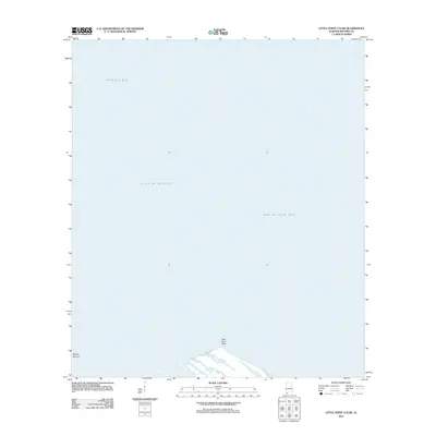
2011 Map of Little Point Clear
USGS Topo · Published 2011About this map
Little Point Clear anchors the southern edge of this coastal survey, where the terrestrial landscape of Baldwin County gives way to the expansive waters of the Gulf Coast. The map illustrates a critical maritime intersection where the deep waters of the Gulf of Mexico meet the protected reaches of the Alabama shoreline. To the north and east, the transition into Mobile Bay and Bon Secour Bay highlights the complex hydrography of the region's estuarine system. These waters are further defined by submerged features such as the Middle Ground, reflecting the shifting shoals and navigational challenges inherent to this part of the coast. This 2011 edition provides a precise record of the shoreline and bathymetric boundaries prior to subsequent coastal changes, serving as a foundational document for understanding the geographic relationship between the peninsula and its surrounding bays.
Find a feature on this map
5 named features on this map. Tap any name to fly to it.
Don’t see what you’re looking for? This feature index may not catch every label — zoom into the map to look around manually.
Map Details
Editions of this 2011 Little Point Clear Map
This is the sole edition of this map. No revisions or reprints were ever made.
Other maps of this area

1921 · Point Clear
USGS Topo · 1:62,500

1921 · Dauphin Island
USGS Topo · 1:62,500

1921 · Delchamps
USGS Topo · 1:62,500

1941 · Cedar Point
USGS Topo · 1:62,500

1941 · Weeks Bay
USGS Topo · 1:62,500

1942 · Fort Morgan
USGS Topo · 1:62,500

1943 · Cedar Point
USGS Topo · 1:62,500

1943 · Weeks Bay
USGS Topo · 1:62,500

1953 · Mobile
USGS Topo · 1:250,000
1956 · Point Clear
USGS Topo · 1:24,000