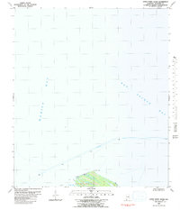
1980 Map of Little Point Clear
USGS Topo · Published 1980About this map
Little Point Clear anchors this coastal survey, marking the thin peninsula that separates the open waters of Mobile Bay from the sheltered reaches of Saxon Bay. This 1980 edition captures the maritime corridor where the Intracoastal Waterway cuts through the bay, guided by several strategic navigational lights positioned along the channel. The map is primarily an aquatic study, detailing the bathymetry and shoreline configuration of Bon Secour Bay at a time when traditional water routes remained central to the region's geography. Researchers will find the delineation of the Tidal Flat areas particularly useful for understanding the shifting coastal environment and natural barriers of the Alabama Gulf Coast during the late twentieth century.
Find a feature on this map
7 named features on this map. Tap any name to fly to it.
Don’t see what you’re looking for? This feature index may not catch every label — zoom into the map to look around manually.
Map Details
Editions of this 1980 Little Point Clear Map
This is the sole edition of this map. No revisions or reprints were ever made.
Other maps of this area

1921 · Point Clear
USGS Topo · 1:62,500

1921 · Dauphin Island
USGS Topo · 1:62,500

1921 · Delchamps
USGS Topo · 1:62,500

1941 · Cedar Point
USGS Topo · 1:62,500

1941 · Weeks Bay
USGS Topo · 1:62,500

1942 · Fort Morgan
USGS Topo · 1:62,500

1943 · Cedar Point
USGS Topo · 1:62,500

1943 · Weeks Bay
USGS Topo · 1:62,500

1953 · Mobile
USGS Topo · 1:250,000
1956 · Point Clear
USGS Topo · 1:24,000