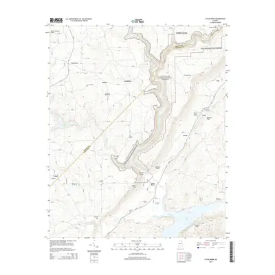
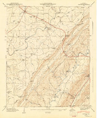
2014 Map of Little River
USGS Topo · Published 2014About this map
Little River Canyon National Preserve dominates this portion of the Cumberland Plateau, where the Little River has carved a massive gorge through Lookout Mountain. This 2014 survey documents the rugged interface of the DeKalb and Cherokee county lines across the deep incision of Little River Canyon. The surrounding upland plateaus are dotted with small agricultural communities and rural outposts like Lickskillet, Dog Town, and Sigsbee, connected by a network of county roads. Local history and genealogy are anchored by numerous rural burial grounds, including Black Oak Cemetery and Tuckers Chapel Cemetery. To the south, the landscape opens toward the waters of Weiss Lake and the prominent rise of Dirtseller Mountain, while the Flying M Ranch Airport serves as a small aviation landmark on the eastern ridge near Shinbone Ridge.
Find a feature on this map
116 named features on this map. Tap any name to fly to it.
Don’t see what you’re looking for? This feature index may not catch every label — zoom into the map to look around manually.
Map Details
Editions of this 2014 Little River Map
This is the sole edition of this map. No revisions or reprints were ever made.
Other maps of this area

1893 · Fort Payne
USGS Topo · 1:125,000

1898 · Fort Payne
USGS Topo · 1:125,000

1900 · Fort Payne
USGS Topo · 1:125,000

1936 · Chavies
USGS Topo · 1:24,000

1946 · Portersville
USGS Topo · 1:24,000

1946 · Ft Payne
USGS Topo · 1:24,000
1946 · Chavies
USGS Topo · 1:24,000
1947 · Ft Payne
USGS Topo · 1:24,000
1947 · Portersville
USGS Topo · 1:24,000
1947 · Chavies
USGS Topo · 1:24,000