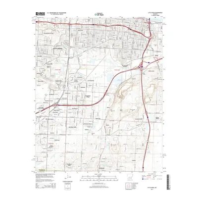
2014 Map of Little Rock
USGS Topo · Published 2014About this map
Little Rock expansion and suburban development dominate this survey, which captures the capital city’s southward growth toward the Pulaski Co and Saline Co boundary. The landscape is a dense network of residential subdivisions like Oak Forest, Cloverdale, and Wakefield Village, interleaved with historical institutions such as Philander Smith Coll and Arkansas Baptist Coll. The central urban core is anchored by the Markham Street Interchange and the Second Street Bridge over David D Terry Lake, while the southern reaches reveal a more varied topography defined by Granite Mtn and Ermentraudt Mtn.
Find a feature on this map
167 named features on this map. Tap any name to fly to it.
Don’t see what you’re looking for? This feature index may not catch every label — zoom into the map to look around manually.
Map Details
Editions of this 2014 Little Rock Map
This is the sole edition of this map. No revisions or reprints were ever made.
Other maps of this area

1891 · Little Rock
USGS Topo · 1:125,000

1893 · Little Rock
USGS Topo · 1:125,000

1935 · Mc Almont
USGS Topo · 1:24,000

1935 · Little Rock
USGS Topo · 1:24,000

1935 · Sweet Home
USGS Topo · 1:24,000

1935 · North Little Rock
USGS Topo · 1:24,000

1935 · Alexander
USGS Topo · 1:48,000

1940 · Woodson
USGS Topo · 1:31,680

1941 · Alexander
USGS Topo · 1:62,500

1943 · Pinnacle Mtn
USGS Topo · 1:31,680
Featured Places
- Little Rock, AR
- North Little Rock, AR
- Brittain, Little Rock
- Hot Springs Junction, Little Rock
- Fairview, Little Rock