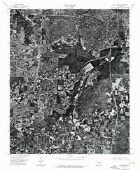
1975 Map of Little Rock
USGS Topo · Published 1976About this map
Little Rock is shown in high-detail orthophotography as it appeared in the mid-1970s, providing a bird’s-eye view of the capital’s urban growth and industrial footprint. This 1975 aerial survey by the Geological Survey captures the dense residential grids of the city center and the sprawling commercial development extending into the surrounding Pulaski County landscape. The winding course of the Arkansas R dominates the northern edge of the sheet, serving as the primary geographical anchor for the region's transport and settlement patterns. Unlike traditional line-drawn topographic maps, this orthophotomosaic offers researchers an actual visual record of every rooftop, parking lot, and wooded plot, making it an invaluable resource for tracing the physical evolution of the city's neighborhoods and infrastructure just before the late 20th-century expansion period.
Find a feature on this map
2 named features on this map. Tap any name to fly to it.
Don’t see what you’re looking for? This feature index may not catch every label — zoom into the map to look around manually.
Map Details
Editions of this 1975 Little Rock Map
This is the sole edition of this map. No revisions or reprints were ever made.
Other maps of this area

1891 · Little Rock
USGS Topo · 1:125,000

1893 · Little Rock
USGS Topo · 1:125,000

1935 · Mc Almont
USGS Topo · 1:24,000

1935 · Little Rock
USGS Topo · 1:24,000

1935 · Sweet Home
USGS Topo · 1:24,000

1935 · North Little Rock
USGS Topo · 1:24,000

1935 · Alexander
USGS Topo · 1:48,000

1940 · Woodson
USGS Topo · 1:31,680

1941 · Alexander
USGS Topo · 1:62,500

1943 · Pinnacle Mtn
USGS Topo · 1:31,680
Featured Places
- Little Rock, AR
- North Little Rock, AR
- Brittain, Little Rock
- Yorkwood, Little Rock
- American Manor, Little Rock