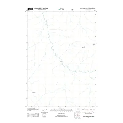
2012 Map of Little Saddle Mountain
USGS Topo · Published 2012About this map
The Lamar River winds through this high-altitude landscape in the Absaroka Range, serving as the primary drainage for numerous tributary streams including Willow Cr and Timothy Cr. This area is defined by its significant peaks and passes, notably Little Saddle Mountain and Hague Mountain to the east, and the traversable Lovely Pass in the southwest. A singular point of human infrastructure, the Cold Creek Patrol Cabin, sits near the confluence of Cold Cr and the main river, indicating the area's use for wilderness management and conservation. The drainage patterns of the Buffalo Fork and Little Lamar River further illustrate the complex hydrology of this high-country terrain during the early 21st century.
Find a feature on this map
12 named features on this map. Tap any name to fly to it.
Don’t see what you’re looking for? This feature index may not catch every label — zoom into the map to look around manually.
Map Details
Editions of this 2012 Little Saddle Mountain Map
This is the sole edition of this map. No revisions or reprints were ever made.
Other maps of this area

1886 · Canyon
USGS Topo · 1:125,000

1895 · Canyon
USGS Topo · 1:125,000

1896 · Canyon
USGS Topo · 1:125,000

1896 · Crandall Creek
USGS Topo · 1:125,000

1899 · Crandall
USGS Topo · 1:125,000

1901 · Canyon
USGS Topo · 1:125,000

1907 · Canyon
USGS Topo · 1:125,000

1911 · Canyon
USGS Topo · 1:125,000

1955 · Ashton
USGS Topo · 1:250,000

1955 · Cody
USGS Topo · 1:250,000