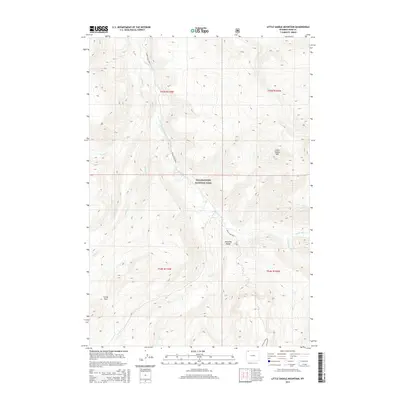
2015 Map of Little Saddle Mountain
USGS Topo · Published 2015About this map
Yellowstone National Park encompasses the central and southern portions of this 2015 study, dominated by the high-elevation peaks of the Absaroka Range. The landscape is defined by the complex drainage network of the Lamar River and its many tributaries, including the Little Lamar River, Cold Cr, and Mist Cr. This region of Wyoming remains a primitive backcountry environment where human presence is primarily marked by long-distance paths such as the Lamar River Trail and the Frost Lake Trail. The topography rises steeply toward Little Saddle Mtn in the northeast, while the crossing at Lovely Pass provides a key navigational point through the high terrain. The confluence of Willow Cr and the Buffalo Fork further illustrates the intricate watershed patterns that have shaped this protected wilderness area since the park's early history.
Find a feature on this map
18 named features on this map. Tap any name to fly to it.
Don’t see what you’re looking for? This feature index may not catch every label — zoom into the map to look around manually.
Map Details
Editions of this 2015 Little Saddle Mountain Map
This is the sole edition of this map. No revisions or reprints were ever made.
Other maps of this area

1886 · Canyon
USGS Topo · 1:125,000

1895 · Canyon
USGS Topo · 1:125,000

1896 · Canyon
USGS Topo · 1:125,000

1896 · Crandall Creek
USGS Topo · 1:125,000

1899 · Crandall
USGS Topo · 1:125,000

1901 · Canyon
USGS Topo · 1:125,000

1907 · Canyon
USGS Topo · 1:125,000

1911 · Canyon
USGS Topo · 1:125,000

1955 · Ashton
USGS Topo · 1:250,000

1955 · Cody
USGS Topo · 1:250,000