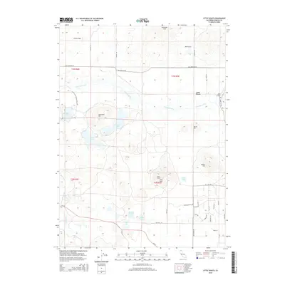
2015 Map of Little Shasta
USGS Topo · Published 2015About this map
The Little Shasta valley unfolds here beneath the high summits of Coyote Ridge and Steamboat Mtn, where the pastoral landscape is defined by the winding course of the Little Shasta River. This high-altitude drainage basin is marked by numerous water bodies including Steamboat Lake, Trout Lake, and Bass Lake, which sit northwest of the settlement. The map provides clear evidence of the ranching and residential patterns in the region, with naming conventions reflected in thoroughfares such as Uba Miba Rancho RD and Harry Cash RD.
Find a feature on this map
48 named features on this map. Tap any name to fly to it.
Don’t see what you’re looking for? This feature index may not catch every label — zoom into the map to look around manually.
Map Details
Editions of this 2015 Little Shasta Map
This is the sole edition of this map. No revisions or reprints were ever made.
Other maps of this area

1886 · Shasta
USGS Topo · 1:250,000

1894 · Shasta
USGS Topo · 1:250,000

1921 · Shasta Valley Sheet No 11
USGS Topo · 1:24,000

1921 · Shasta Valley Sheet No 6
USGS Topo · 1:24,000

1921 · Shasta Valley Sheet No 2
USGS Topo · 1:24,000

1922 · Shasta Valley Sheet No 12
USGS Topo · 1:24,000

1922 · Shasta Valley Sheet No 4
USGS Topo · 1:24,000

1922 · Shasta Valley Sheet No 5
USGS Topo · 1:24,000

1932 · Yreka
USGS Topo · 1:96,000

1934 · Macdoel
USGS Topo · 1:96,000