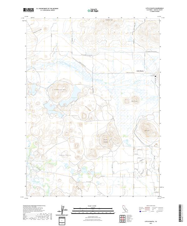
2021 Map of Little Shasta
USGS Topo · Published 2021About this map
Little Shasta sits at the northeastern edge of the Shasta Valley, a landscape defined by seasonal wetlands and the winding course of the Little Shasta River. This high-desert terrain is punctuated by prominent volcanic and geological features, including the height of Steamboat Mtn and the nearby Steamboat Lake. To the south, the valley floor contains several small, potentially saline water bodies like Salt Lake and Barton Lake, reflecting the unique drainage patterns of the area.
Find a feature on this map
49 named features on this map. Tap any name to fly to it.
Don’t see what you’re looking for? This feature index may not catch every label — zoom into the map to look around manually.
Map Details
Editions of this 2021 Little Shasta Map
This is the sole edition of this map. No revisions or reprints were ever made.
Other maps of this area

1886 · Shasta
USGS Topo · 1:250,000

1894 · Shasta
USGS Topo · 1:250,000

1921 · Shasta Valley Sheet No 11
USGS Topo · 1:24,000

1921 · Shasta Valley Sheet No 6
USGS Topo · 1:24,000

1921 · Shasta Valley Sheet No 2
USGS Topo · 1:24,000

1922 · Shasta Valley Sheet No 12
USGS Topo · 1:24,000

1922 · Shasta Valley Sheet No 4
USGS Topo · 1:24,000

1922 · Shasta Valley Sheet No 5
USGS Topo · 1:24,000

1932 · Yreka
USGS Topo · 1:96,000

1934 · Macdoel
USGS Topo · 1:96,000