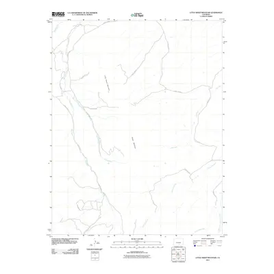
2010 Map of Little Sheep Mountain
USGS Topo · Published 2010About this map
Little Sheep Mountain and Sheep Mountain define the high drainage divides of this Costilla County landscape as it appeared in 2010. The terrain is deeply etched by a branching network of watercourses, most notably the Huerfano River in the northwest corner and the extensive reach of Pass Creek which travels the western half of the quadrangle. Smaller tributaries like Spring Branch and Oak Creek feed into larger systems, illustrating the complex watershed patterns of the region.
Find a feature on this map
23 named features on this map. Tap any name to fly to it.
Don’t see what you’re looking for? This feature index may not catch every label — zoom into the map to look around manually.
Map Details
Editions of this 2010 Little Sheep Mountain Map
This is the sole edition of this map. No revisions or reprints were ever made.
Other maps of this area

1889 · Huerfano Park
USGS Topo · 1:125,000

1892 · Huerfano Park
USGS Topo · 1:125,000

1954 · Trinidad
USGS Topo · 1:250,000

1955 · Trinidad
USGS Topo · 1:250,000

1958 · Trinidad
USGS Topo · 1:250,000

1959 · Trinidad
USGS Topo · 1:250,000

1963 · La Veta Pass
USGS Topo · 1:24,000
1963 · La Veta
USGS Topo · 1:24,000
1967 · Creager Reservoir
USGS Topo · 1:24,000
1967 · Russell
USGS Topo · 1:24,000