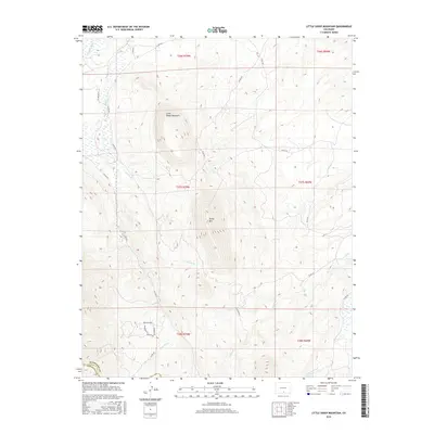
2016 Map of Little Sheep Mountain
USGS Topo · Published 2016About this map
Little Sheep Mountain and its neighbor Sheep Mtn dominate this high-altitude landscape along the border of Huerfano and Costilla Counties. The area is defined by a dense network of mountain drainage systems, where the headwaters of the Huerfano River are joined by numerous tributaries including Pass Cr, Oak Cr, and Spring Br. Modern infrastructure is concentrated in the southern sections, where a grid of local roads serves the foothills. This network includes named routes like Houchin Blvd, Thompson Rd, and Parsons Rd, indicating localized development and land use patterns adjacent to the steep mountain slopes. The map provides a clear record of the intersection between high-elevation terrain and the rural road systems that facilitate access to these remote Colorado summits.
Find a feature on this map
29 named features on this map. Tap any name to fly to it.
Don’t see what you’re looking for? This feature index may not catch every label — zoom into the map to look around manually.
Map Details
Editions of this 2016 Little Sheep Mountain Map
This is the sole edition of this map. No revisions or reprints were ever made.
Other maps of this area

1889 · Huerfano Park
USGS Topo · 1:125,000

1892 · Huerfano Park
USGS Topo · 1:125,000

1954 · Trinidad
USGS Topo · 1:250,000

1955 · Trinidad
USGS Topo · 1:250,000

1958 · Trinidad
USGS Topo · 1:250,000

1959 · Trinidad
USGS Topo · 1:250,000

1963 · La Veta Pass
USGS Topo · 1:24,000
1963 · La Veta
USGS Topo · 1:24,000
1967 · Creager Reservoir
USGS Topo · 1:24,000
1967 · Russell
USGS Topo · 1:24,000