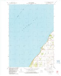
1982 Map of Little Sturgeon SW
USGS Topo · Published 1983About this map
Green Bay dominates the western half of this coastal survey, where the Indefinite Boundary between Marinette and Door Counties extends into the open water. Along the shoreline, the small settlement of Red River serves as a focal point near the mouth of Sugar Creek, which winds through the townships of Gardner, Union, and Brussels. The landscape is characterized by a mix of agricultural plots and small wooded tracts, organized by a grid of rural lanes with local names like Fox Lane and Lovers Lane. Genealogists and local historians will find the White Star Cem particularly notable, located near the intersection of White Star Road and Brussels Road. This map captures the area after the 1979 aerial revisions, showing established recreation spots like Sugar Creek County Park and the nearby Boat Ramp that provide access to the bay.
Find a feature on this map
18 named features on this map. Tap any name to fly to it.
Don’t see what you’re looking for? This feature index may not catch every label — zoom into the map to look around manually.
Map Details
Editions of this 1982 Little Sturgeon SW Map
This is the sole edition of this map. No revisions or reprints were ever made.
Other maps of this area

1952 · Casco
USGS Topo · 1:62,500

1954 · New Franken
USGS Topo · 1:62,500

1954 · Manitowoc
USGS Topo · 1:250,000

1956 · Oconto
USGS Topo · 1:62,500

1958 · Manitowoc
USGS Topo · 1:250,000

1961 · Little Sturgeon
USGS Topo · 1:62,500
1974 · Oconto East
USGS Topo · 1:24,000
1974 · Oconto SE
USGS Topo · 1:24,000
1974 · Peshtigo Harbor
USGS Topo · 1:24,000

1978 · Namur
USGS Topo · 1:24,000