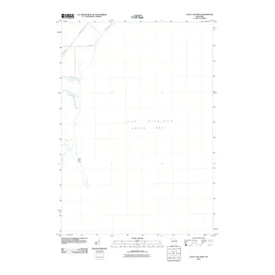
2010 Map of Little Tail Point
USGS Topo · Published 2010About this map
Little Tail Point extends into the waters of Green Bay in this coastal survey of the Lake Michigan shoreline. The map documents a sparsely developed area where the land meets the marshy edges of the bay, defined by the winding course of the Little Suamico River as it reaches its outlet. Local infrastructure is concentrated in the northwest corner, where County Hwy-Rd S and Locust Rd provide access to seasonal and residential properties. Small tributaries like Tibbet Creek and Kirchner Creek drain the low-lying terrain, highlighting the transition from inland agricultural fields to the aquatic environment of Lake Michigan. This 2010 edition serves as a precise record of the shoreline's shape and the residential road network before further coastal development altered the local geography.
Find a feature on this map
11 named features on this map. Tap any name to fly to it.
Don’t see what you’re looking for? This feature index may not catch every label — zoom into the map to look around manually.
Map Details
Editions of this 2010 Little Tail Point Map
This is the sole edition of this map. No revisions or reprints were ever made.
Other maps of this area

1954 · Green Bay West
USGS Topo · 1:24,000

1954 · New Franken
USGS Topo · 1:62,500

1954 · Green Bay East
USGS Topo · 1:24,000

1954 · Manitowoc
USGS Topo · 1:250,000

1954 · Green Bay
USGS Topo · 1:62,500

1955 · Green Bay
USGS Topo · 1:250,000

1956 · Oconto
USGS Topo · 1:62,500

1956 · Oconto Falls
USGS Topo · 1:62,500

1958 · Manitowoc
USGS Topo · 1:250,000

1974 · Abrams
USGS Topo · 1:24,000