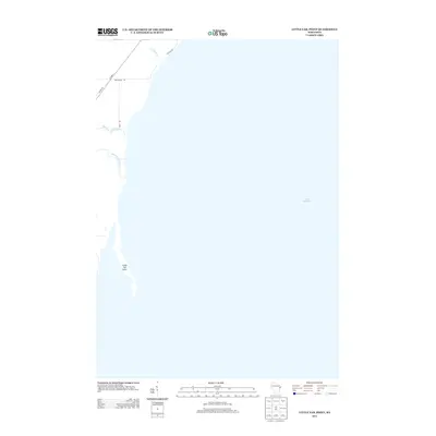
2013 Map of Little Tail Point
USGS Topo · Published 2013About this map
Little Tail Point stretches into the waters of Green Bay along the western shore of Lake Michigan, defining a landscape where narrow coastal tributaries meet the lake. This 2013 survey documents the shoreline at a time when local access was shaped by routes like Co Hwy S and Lade Beach Rd. The map tracks the drainage patterns of small coastal waterways, including Kirchner Cr, Tibbet Creek, and the mouth of the Little Suamico River. While largely dominated by the open water and the distinctive projection of the point, the inland portions show the established grid of local connectors like Rost Rd and Cottage Rd, which serve the residential and recreational properties along the Wisconsin coast.
Find a feature on this map
10 named features on this map. Tap any name to fly to it.
Don’t see what you’re looking for? This feature index may not catch every label — zoom into the map to look around manually.
Map Details
Editions of this 2013 Little Tail Point Map
This is the sole edition of this map. No revisions or reprints were ever made.
Other maps of this area

1954 · Green Bay West
USGS Topo · 1:24,000

1954 · New Franken
USGS Topo · 1:62,500

1954 · Green Bay East
USGS Topo · 1:24,000

1954 · Manitowoc
USGS Topo · 1:250,000

1954 · Green Bay
USGS Topo · 1:62,500

1955 · Green Bay
USGS Topo · 1:250,000

1956 · Oconto
USGS Topo · 1:62,500

1956 · Oconto Falls
USGS Topo · 1:62,500

1958 · Manitowoc
USGS Topo · 1:250,000

1974 · Abrams
USGS Topo · 1:24,000