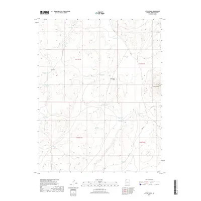
2018 Map of Little Tanks
USGS Topo · Published 2018About this map
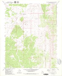
Diamond Butte stands as a prominent landmark in this high-desert reach of Mohave County, where the landscape is defined by an extensive system of water management features necessary for life in the arid West. The 2018 survey reveals a network of man-made catchments including Alva Shelly Reservoir, Walter Shelley Reservoir, and the dual Sevy Draw Reservoir Number One and Number Two. These features, alongside the namesake Little Tanks, suggest a history of ranching or livestock management integrated into the natural drainage of Sevy Draw and the broad Main Street Valley. The map documents the persistent human effort to capture seasonal runoff in a region where water sources like Nina Pond and Rattlesnake Reservoir are critical infrastructure. This modern topography captures the region as it remains intersected by rural routes such as Co HWY 105 and Co RD 5, providing a detailed look at contemporary land use in a sparsely populated section of the Arizona strip.
Find a feature on this map
28 named features on this map. Tap any name to fly to it.
Don’t see what you’re looking for? This feature index may not catch every label — zoom into the map to look around manually.
Map Details
Editions of this 2018 Little Tanks Map
This is the sole edition of this map. No revisions or reprints were ever made.
Other maps of this area

1886 · Mt. Trumbull
USGS Topo · 1:250,000

1892 · Mt. Trumbull
USGS Topo · 1:250,000

1953 · Grand Canyon
USGS Topo · 1:250,000

1957 · Grand Canyon
USGS Topo · 1:250,000

1958 · Grand Canyon
USGS Topo · 1:250,000

1960 · Grand Canyon
USGS Topo · 1:250,000
1971 · Poverty Spring
USGS Topo · 1:24,000
1971 · Poverty Knoll
USGS Topo · 1:24,000
1971 · Jones Hill
USGS Topo · 1:24,000
1979 · Sullivan Draw North
USGS Topo · 1:24,000