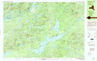
1990 Map of Little Tupper Lake
USGS Topo · Published 1990About this map
Adirondack Park dominates this landscape, showing a dense network of water bodies and high peaks as they appeared in 1990. The topography is defined by the expansive Little Tupper Lake and Lila Lake, connected through a complex system of ponds and streams like the Bog River. A significant human presence is noted at Whitney Headquarters on the eastern shore of the main lake, while the small settlements of Sabattis and Robinwood mark the sparse interior development of the era.
Find a feature on this map
67 named features on this map. Tap any name to fly to it.
Don’t see what you’re looking for? This feature index may not catch every label — zoom into the map to look around manually.
Map Details
Editions of this 1990 Little Tupper Lake Map
This is the sole edition of this map. No revisions or reprints were ever made.
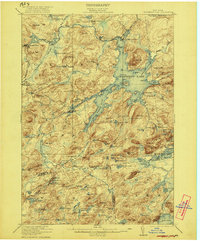
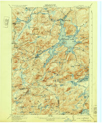
Other maps of this area

1903 · Big Moose
USGS Topo · 1:62,500

1903 · Raquette Lake
USGS Topo · 1:62,500

1903 · Blue Mountain
USGS Topo · 1:62,500

1904 · Long Lake
USGS Topo · 1:62,500

1907 · Tupper Lake
USGS Topo · 1:62,500

1919 · Cranberry Lake
USGS Topo · 1:62,500
1921 · Cranberry Lake
USGS Topo · 1:62,500
1931 · Cranberry Lake
USGS Topo · 1:62,500

1948 · Ogdensburg
USGS Topo · 1:250,000

1950 · Utica
USGS Topo · 1:250,000