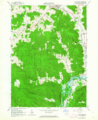
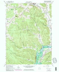
1962 Map of Little Valley
USGS Topo · Published 1964About this map
The Allegany Indian Reservation and the rising waters of the Allegheny Reservoir define this portion of Cattaraugus County in the early 1960s. This survey records a landscape in transition, with a light-blue pattern along the Allegheny River indicating areas subject to controlled inundation. Higher ground is heavily dominated by the State Reforestation Area, while the valleys are marked by the presence of the Erie-Lackawanna railroad and established community centers like Little Valley and Salamanca.
Find a feature on this map
71 named features on this map. Tap any name to fly to it.
Don’t see what you’re looking for? This feature index may not catch every label — zoom into the map to look around manually.
Map Details
Editions of this 1962 Little Valley Map
5 editions found
Other maps of this area

1900 · Salamanca
USGS Topo · 1:62,500

1922 · Randolph
USGS Topo · 1:62,500

1923 · Randolph
USGS Topo · 1:62,500

1923 · Cattaraugus
USGS Topo · 1:62,500

1924 · Ellicottville
USGS Topo · 1:62,500

1938 · Cattaraugus
USGS Topo · 1:62,500

1938 · Salamanca
USGS Topo · 1:62,500

1941 · Cattaraugus
USGS Topo · 1:62,500

1941 · Ellicottville
USGS Topo · 1:62,500

1943 · Randolph
USGS Topo · 1:62,500