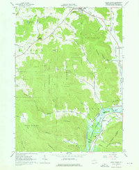
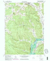
1962 Map of Little Valley
USGS Topo · Published 1976About this map
Allegany Indian Reservation lands and the valley of the Allegheny River define the southern landscape of this 1962 survey. The topographical data captures a period of transition for the river corridor, specifically noting areas subject to controlled inundation related to the Allegheny Reservoir. Indigenous heritage and community life are grounded in landmarks like the Missionary Indian Ch and the Full Gospel Mission, alongside settlements such as Jimmersontown and Shongo.
Find a feature on this map
71 named features on this map. Tap any name to fly to it.
Don’t see what you’re looking for? This feature index may not catch every label — zoom into the map to look around manually.
Map Details
Editions of this 1962 Little Valley Map
5 editions found
Other maps of this area

1900 · Salamanca
USGS Topo · 1:62,500

1922 · Randolph
USGS Topo · 1:62,500

1923 · Randolph
USGS Topo · 1:62,500

1923 · Cattaraugus
USGS Topo · 1:62,500

1924 · Ellicottville
USGS Topo · 1:62,500

1938 · Cattaraugus
USGS Topo · 1:62,500

1938 · Salamanca
USGS Topo · 1:62,500

1941 · Cattaraugus
USGS Topo · 1:62,500

1941 · Ellicottville
USGS Topo · 1:62,500

1943 · Randolph
USGS Topo · 1:62,500