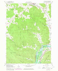
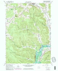
1962 Map of Little Valley
USGS Topo · Published 1980About this map
The Allegany Indian Reservation and the southern flow of the Allegheny River anchor this 1960s-era study of Cattaraugus County. The landscape is defined by the sharp transition between the upland State Reforestation Area and the fertile river valley floor, where the Conrail line follows the water's edge through Salamanca. Smaller settlements like Jimmerson Town and Shongo appear along the river, illustrating the historic reliance on the valley corridor for transportation and community building.
Find a feature on this map
65 named features on this map. Tap any name to fly to it.
Don’t see what you’re looking for? This feature index may not catch every label — zoom into the map to look around manually.
Map Details
Editions of this 1962 Little Valley Map
5 editions found
Other maps of this area

1900 · Salamanca
USGS Topo · 1:62,500

1922 · Randolph
USGS Topo · 1:62,500

1923 · Randolph
USGS Topo · 1:62,500

1923 · Cattaraugus
USGS Topo · 1:62,500

1924 · Ellicottville
USGS Topo · 1:62,500

1938 · Cattaraugus
USGS Topo · 1:62,500

1938 · Salamanca
USGS Topo · 1:62,500

1941 · Cattaraugus
USGS Topo · 1:62,500

1941 · Ellicottville
USGS Topo · 1:62,500

1943 · Randolph
USGS Topo · 1:62,500