1983 Map of Little Valley
USGS Topo · Published 1983About this map
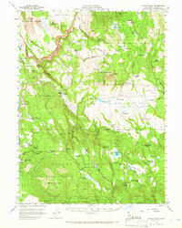
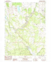
The Little Valley settlement serves as the focal point of this northern California landscape, positioned where Horse Creek and Clarks Valley drainage meets the upper reaches of the Pit River canyon. In the early 1980s, the area reflects a working landscape defined by timber, ranching, and transport infrastructure. The Union Pacific and Pacific Union railroad lines wind through the valley floor, supporting the local economy alongside several extraction sites like the Muck Pit and various borrow pits. Notable human landmarks include the Klett Homestead and the distinctive The Round Barn, which provide tangible links to the area's agricultural history. Much of the surrounding territory is managed as public land, split between the Modoc National Forest and Lassen National Forest. Topographically, the map is dominated by the sequential volcanic landmarks of First Butte, Second Butte, Third Butte, and Fourth Butte, which overlook the northern grazing grounds of Muck Valley.
Find a feature on this map
39 named features on this map. Tap any name to fly to it.
Don’t see what you’re looking for? This feature index may not catch every label — zoom into the map to look around manually.
Map Details
Editions of this 1983 Little Valley Map
This is the sole edition of this map. No revisions or reprints were ever made.
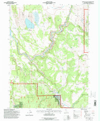
Historical Maps of Little Valley Through Time
7 maps found