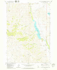
1979 Map of Little Wood River Reservoir
USGS Topo · Published 1979About this map
Little Wood River Reservoir dominates this high-altitude landscape in Blaine County, where water management and ranching terrain converge. The reservoir, situated at an elevation of 5235 feet, serves as a central hub for the Little Wood River, which flows through wide drainage areas like Campbell Flats and Burgess Flats. The area's topography is marked by significant elevation changes, from the heights of Bell Mountain and Muldoon Summit to the deep recesses of Sawmill Canyon and Crooked Canyon. Extensive trail systems, including various Jeep Trails and Pack Trails, crisscross the ridges and creek bottoms, indicating a landscape utilized for recreation and resource management. Numerous water sources such as Last Chance Springs, Chokecherry Spring, and Sunset Spring dot the terrain, highlighting the critical importance of spring water in this mountainous Idaho environment during the late 1970s.
Find a feature on this map
41 named features on this map. Tap any name to fly to it.
Don’t see what you’re looking for? This feature index may not catch every label — zoom into the map to look around manually.
Map Details
Editions of this 1979 Little Wood River Reservoir Map
2 editions found
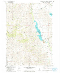
Other maps of this area

1895 · Hailey
USGS Topo · 1:125,000

1897 · Hailey
USGS Topo · 1:125,000

1935 · MacKay
USGS Topo · 1:96,000

1955 · Idaho Falls
USGS Topo · 1:250,000

1955 · Hailey
USGS Topo · 1:250,000

1958 · Idaho Falls
USGS Topo · 1:250,000

1959 · Hailey
USGS Topo · 1:250,000

1960 · Muldoon Canyon
USGS Topo · 1:62,500

1962 · Hailey
USGS Topo · 1:250,000

1967 · Baugh Creek SW
USGS Topo · 1:24,000