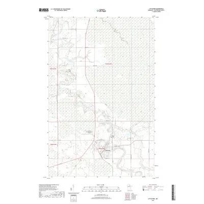
2019 Map of Littlefork
USGS Topo · Published 2019About this map
The Little Fork River meanders sharply through the north-central Minnesota landscape, anchoring the settlement of Littlefork. This 2019 survey illustrates the community's layout at the junction of Co Hwy 22 and Co Hwy 43, where a street grid includes historically significant corridors such as Main St, Industrial Ave, and Electric Ave. The town is supported by local infrastructure including the Littlefork-Municipal/Hanover Airport to the west and the Littlefork Cem situated along the riverbanks to the north.
Find a feature on this map
37 named features on this map. Tap any name to fly to it.
Don’t see what you’re looking for? This feature index may not catch every label — zoom into the map to look around manually.
Map Details
Editions of this 2019 Littlefork Map
This is the sole edition of this map. No revisions or reprints were ever made.
Other maps of this area

1919 · Pelland
USGS Topo · 1:62,500

1919 · Happy Land
USGS Topo · 1:62,500

1919 · International Falls
USGS Topo · 1:62,500

1954 · International Falls
USGS Topo · 1:250,000

1957 · International Falls
USGS Topo · 1:250,000

1958 · International Falls
USGS Topo · 1:250,000

1969 · Ericsburg NW
USGS Topo · 1:24,000

1969 · Ericsburg SW
USGS Topo · 1:24,000
1969 · International Falls
USGS Topo · 1:24,000

1970 · Devlin
USGS Topo · 1:24,000