
1969 Map of Ericsburg NW
USGS Topo · Published 1971About this map
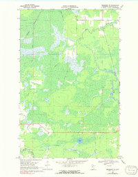
The Rat Root River meanders through a landscape defined by extensive wetlands and seasonal access routes in this 1960s study of Koochiching County. The terrain is crisscrossed by a Winter Trail, reflecting the logistical realities of navigating this water-heavy environment before modern road networks were fully established. Near the northern boundary, the Burlington Northern railroad cuts through the forest, providing a critical industrial link for the region's timber and natural resources. Small-scale resource extraction is evident at the Gravel Pit near the riverbank, while the presence of a Flowing Well and Moose Lake highlights the area's complex hydrology. To the south, Beaver Brook feeds into the drainage system, illustrating the intricate network of small waterways that dominate this northern Minnesota wilderness.
Find a feature on this map
7 named features on this map. Tap any name to fly to it.
Don’t see what you’re looking for? This feature index may not catch every label — zoom into the map to look around manually.
Map Details
Editions of this 1969 Ericsburg NW Map
2 editions found
Other maps of this area

1919 · Pelland
USGS Topo · 1:62,500

1919 · Happy Land
USGS Topo · 1:62,500

1919 · International Falls
USGS Topo · 1:62,500

1954 · International Falls
USGS Topo · 1:250,000

1957 · International Falls
USGS Topo · 1:250,000

1958 · International Falls
USGS Topo · 1:250,000

1963 · Ranier
USGS Topo · 1:24,000

1969 · Ericsburg
USGS Topo · 1:24,000

1969 · Ericsburg SE
USGS Topo · 1:24,000

1969 · Ranier
USGS Topo · 1:24,000