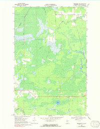
1969 Map of Ericsburg NW
USGS Topo · Published 1991About this map
Rat Root River meanders through the heart of this northern Minnesota landscape, defining a terrain dominated by extensive wetlands and seasonal routes. The presence of several stretches marked as Winter Trail highlights the importance of frozen ground for navigation and timber transport in this Koochiching County wilderness. The Burlington Northern railroad cuts a straight line through the northwestern corner, providing a stark industrial contrast to the surrounding marshes. Near the center, Moose Lake and the smaller Beaver Brook drain the low-lying interior, while a solitary Gravel Pit near the northern boundary indicates the sparse but necessary infrastructure required for road maintenance in this water-heavy environment. This survey, grounded in 1968 aerial photography, preserves the intricate hydrological network of the Border Lakes region before modern land management shifted local access patterns.
Find a feature on this map
6 named features on this map. Tap any name to fly to it.
Don’t see what you’re looking for? This feature index may not catch every label — zoom into the map to look around manually.
Map Details
Editions of this 1969 Ericsburg NW Map
2 editions found
Other maps of this area

1919 · Pelland
USGS Topo · 1:62,500

1919 · Happy Land
USGS Topo · 1:62,500

1919 · International Falls
USGS Topo · 1:62,500

1954 · International Falls
USGS Topo · 1:250,000

1957 · International Falls
USGS Topo · 1:250,000

1958 · International Falls
USGS Topo · 1:250,000

1963 · Ranier
USGS Topo · 1:24,000

1969 · Ericsburg NW
USGS Topo · 1:24,000

1969 · Ericsburg
USGS Topo · 1:24,000

1969 · Ericsburg SE
USGS Topo · 1:24,000