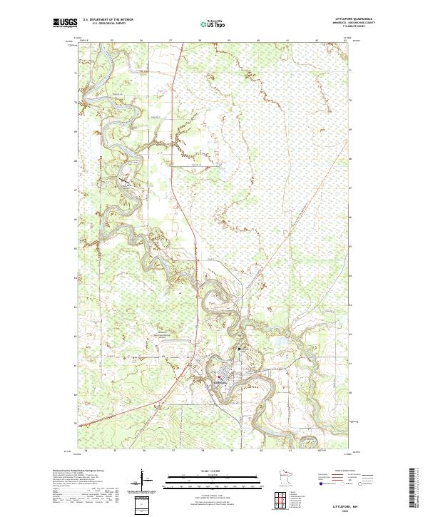
2022 Map of Littlefork
USGS Topo · Published 2022About this map
The Little Fork River meanders sharply through the landscape of Koochiching County, anchoring the town of Littlefork in this 2022 survey. This northern Minnesota community is a focal point of regional transport, where local routes like Main St and Industrial Ave intersect with the extensive Blue Ox State Trail. The map reveals a specialized infrastructure for this rural area, featuring both the Littlefork Municipal/Hanover Airport and the smaller West Wind Airport to the northwest. Genealogists and local historians can locate the Littlefork Cem near a bend in the river, while the surrounding terrain is defined by a dense network of water systems, including Beaver Brook, and numerous named township and county roads that provide access to the timbered wetlands and river flats characteristic of this border-country region.
Find a feature on this map
39 named features on this map. Tap any name to fly to it.
Don’t see what you’re looking for? This feature index may not catch every label — zoom into the map to look around manually.
Map Details
Editions of this 2022 Littlefork Map
This is the sole edition of this map. No revisions or reprints were ever made.
Other maps of this area

1919 · Pelland
USGS Topo · 1:62,500

1919 · Happy Land
USGS Topo · 1:62,500

1919 · International Falls
USGS Topo · 1:62,500

1954 · International Falls
USGS Topo · 1:250,000

1957 · International Falls
USGS Topo · 1:250,000

1958 · International Falls
USGS Topo · 1:250,000

1969 · Ericsburg NW
USGS Topo · 1:24,000

1969 · Ericsburg SW
USGS Topo · 1:24,000
1969 · International Falls
USGS Topo · 1:24,000

1970 · Devlin
USGS Topo · 1:24,000