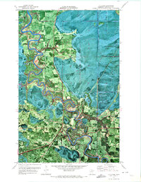
1970 Map of Littlefork
USGS Topo · Published 1973About this map
Little Fork River meanders dramatically across this landscape, forming tight oxbows and loops that define the northern Minnesota wilderness near the Canadian border. This 1970 orthophotomap combines aerial photography with topographic data, revealing the dense forest and marshland patterns surrounding the settlement of Littlefork. The infrastructure of the era is clearly visible, from the Burlington Northern railroad line cutting through the terrain to the Littlefork Airport and local Radio Tower. Religious and community life is anchored at the Northwood Chapel, while the river's utility is monitored by a Gaging Station. The map captures the remote character of the region, where a Winter Trail provides seasonal access across wetlands that are otherwise impassable, reflecting the specialized transportation needs of Koochiching County.
Find a feature on this map
13 named features on this map. Tap any name to fly to it.
Don’t see what you’re looking for? This feature index may not catch every label — zoom into the map to look around manually.
Map Details
Editions of this 1970 Littlefork Map
This is the sole edition of this map. No revisions or reprints were ever made.
Other maps of this area

1919 · Pelland
USGS Topo · 1:62,500

1919 · Happy Land
USGS Topo · 1:62,500

1919 · International Falls
USGS Topo · 1:62,500

1954 · International Falls
USGS Topo · 1:250,000

1957 · International Falls
USGS Topo · 1:250,000

1958 · International Falls
USGS Topo · 1:250,000

1969 · Ericsburg NW
USGS Topo · 1:24,000

1969 · Ericsburg SW
USGS Topo · 1:24,000
1969 · International Falls
USGS Topo · 1:24,000

1970 · Devlin
USGS Topo · 1:24,000