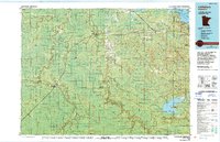
1978 Map of Littlefork
USGS Topo · Published 1994About this map
The confluence of the Little Fork River and the Big Fork River anchors this Northwoods landscape, where timber and water resources defined the regional economy during the late 1970s. The Minnesota Dakota and Western RR cuts through the territory, linking the river settlements of Littlefork and Big Falls. Large tracts of protected land dominate the map, including the Smoke Bear State Forest and portions of Voyageurs National Park along the shores of Kabetogama Lake. A network of lookout towers, such as Happy Land Lookout Tower and Dentaybow Lookout Tower, underscores the importance of forest fire monitoring in this heavily wooded area. Further southeast, the Nett Lake Indian Reservation borders the expansive Nett Lake, illustrating the intersection of state, federal, and tribal lands in the Rainy River basin.
Find a feature on this map
53 named features on this map. Tap any name to fly to it.
Don’t see what you’re looking for? This feature index may not catch every label — zoom into the map to look around manually.
Map Details
Editions of this 1978 Littlefork Map
This is the sole edition of this map. No revisions or reprints were ever made.
Other maps of this area

1918 · Zora
USGS Topo · 1:62,500

1919 · Zora
USGS Topo · 1:62,500

1919 · Lundgren
USGS Topo · 1:62,500

1919 · Gemmell
USGS Topo · 1:62,500

1919 · Pelland
USGS Topo · 1:62,500

1919 · Birchdale
USGS Topo · 1:62,500

1919 · I
USGS Topo · 1:62,500

1919 · Happy Land
USGS Topo · 1:62,500

1919 · M
USGS Topo · 1:62,500

1919 · Margie
USGS Topo · 1:62,500