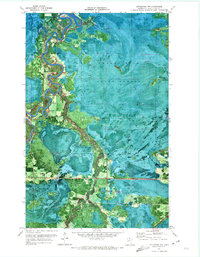
1970 Map of Littlefork NW
USGS Topo · Published 1973About this map
Smokey Bear State Forest dominates this northern Minnesota landscape, where the meandering course of the Big Fork River carves deep oxbows and loops through a dense wetland environment. This 1970 orthophotomap combines aerial photography with topographic detail, capturing the remote character of Koochiching County. Near the riverbanks, the Riverside Cem provides a specific point of interest for local history and genealogy. The map also documents the practical infrastructure of the era, from several Gravel Pit excavations to an extensive network of Winter Trails that crisscross the saturated lowlands, indicating a landscape where movement was historically dictated by the freezing of the ground.
Find a feature on this map
6 named features on this map. Tap any name to fly to it.
Don’t see what you’re looking for? This feature index may not catch every label — zoom into the map to look around manually.
Map Details
Editions of this 1970 Littlefork NW Map
This is the sole edition of this map. No revisions or reprints were ever made.
Other maps of this area

1919 · Pelland
USGS Topo · 1:62,500

1919 · Happy Land
USGS Topo · 1:62,500

1943 · Lindford
USGS Topo · 1:62,500

1954 · International Falls
USGS Topo · 1:250,000

1957 · International Falls
USGS Topo · 1:250,000

1958 · International Falls
USGS Topo · 1:250,000

1970 · Devlin
USGS Topo · 1:24,000

1970 · Littlefork SE
USGS Topo · 1:24,000
1970 · Littlefork
USGS Topo · 1:24,000

1970 · Littlefork SW
USGS Topo · 1:24,000