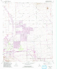
1957 Map of Littlerock
USGS Topo · Published 1993About this map
Littlerock and Pearblossom anchor this Antelope Valley landscape, where desert irrigation and infrastructure intersect with the geologic realities of the San Andreas Rift Zone. The map illustrates a community shaped by water management, notably featuring the California Aqueduct and the massive Pearblossom Pumping Plant. The residential grid of Antelope Center spreads north of Boulevard, supported by local institutions like Littlerock High Sch and Alpine Sch.
Find a feature on this map
36 named features on this map. Tap any name to fly to it.
Don’t see what you’re looking for? This feature index may not catch every label — zoom into the map to look around manually.
Map Details
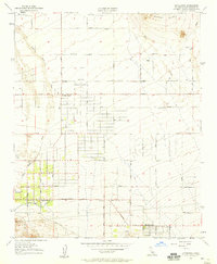
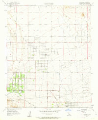
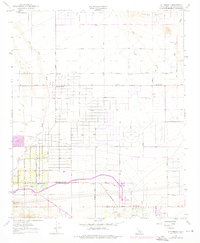
Editions of this 1957 Littlerock Map
4 editions found
Other maps of this area

1900 · Tujunga
USGS Topo · 1:62,500

1901 · Southern California Sheet No. 1
USGS Topo · 1:250,000

1903 · Rock Creek
USGS Topo · 1:62,500

1904 · Southern California Sheet No. 1
USGS Topo · 1:250,000

1915 · Elizabeth Lake
USGS Topo · 1:125,000

1917 · Elizabeth Lake
USGS Topo · 1:125,000
1930 · Lovejoy Springs
USGS Topo · 1:24,000
1930 · Little Rock
USGS Topo · 1:24,000
1930 · Llano
USGS Topo · 1:24,000
1930 · Pearland
USGS Topo · 1:24,000