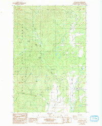
1986 Map of Littlerock
USGS Topo · Published 1993About this map
Mima Mounds Natural Area defines the southeast quadrant of this landscape, showcasing the unique geological formations just west of the Littlerock settlement. To the north and west, the terrain rises into the Black Hills and the dense timberlands of Capitol State Forest. The geography is shaped by numerous drainages, including Waddell Creek and the Black River, which supported the early logging and settlement history of the region.
Find a feature on this map
40 named features on this map. Tap any name to fly to it.
Don’t see what you’re looking for? This feature index may not catch every label — zoom into the map to look around manually.
Map Details
Editions of this 1986 Littlerock Map
2 editions found
Other maps of this area

1916 · Chehalis
USGS Topo · 1:125,000

1937 · Olympia
USGS Topo · 1:62,500

1939 · Shelton
USGS Topo · 1:62,500

1940 · Tenino
USGS Topo · 1:62,500

1941 · Gate
USGS Topo · 1:62,500

1944 · Tenino
USGS Topo · 1:62,500

1949 · Tenino
USGS Topo · 1:62,500

1949 · Olympia
USGS Topo · 1:62,500

1953 · Hoquiam
USGS Topo · 1:250,000

1953 · Rochester
USGS Topo · 1:62,500