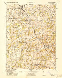
1944 Map of Littlestown
USGS Topo · Published 1944About this map
Littlestown sits at the northern edge of this 1944 survey, serving as a regional hub where the Pennsylvania RR and several roads converge just above the state line. The map illustrates a landscape shaped by local industry and agriculture during the war years, with the boundary between Adams County and Carroll County bisecting a terrain of rolling hills and creek valleys. Evidence of a mill-based economy is scattered along the watercourses, including Menger Mill on Piney Creek and the Pipe Creek Flour Mill further south.
Find a feature on this map
39 named features on this map. Tap any name to fly to it.
Don’t see what you’re looking for? This feature index may not catch every label — zoom into the map to look around manually.
Map Details
Editions of this 1944 Littlestown Map
2 editions found

Other maps of this area

1905 · Westminster
USGS Topo · 1:62,500

1908 · Gettysburg
USGS Topo · 1:62,500

1911 · Taneytown
USGS Topo · 1:62,500

1920 · Hanover
USGS Topo · 1:62,500

1922 · Hanover
USGS Topo · 1:62,500

1942 · Gettysburg
USGS Topo · 1:125,000

1944 · Manchester
USGS Topo · 1:31,680

1944 · Union Bridge
USGS Topo · 1:31,680

1944 · Gettysburg
USGS Topo · 1:31,680

1944 · New Windsor
USGS Topo · 1:31,680