
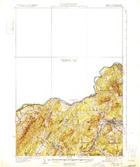
1931 Map of Littleton
USGS Topo · Published 1931About this map
The Connecticut River forms the contested state boundary in this 1929 survey, which captures the White Mountains foothills during a period of transition. While much of the northwestern portion remains a Preliminary Edition Unsurveyed Area, the settled regions of Littleton and Lyman are documented with precision. The transportation network of the early thirties is anchored by the Boston and Maine RR and the Dartmouth College Road State Highway No 10, reflecting the importance of both rail and early motor tourism to the region. Local life is centered around numerous district schools, including the North Monroe Sch and Slate Ledge Sch, while the presence of Mining Hill and Slate Ledge points to the area's extractive history. The landscape is dotted with prominent family-named elevations like Albee Hill and Walker Mtn, and recreational water bodies such as Partridge Lake and Ogontz Lake.
Find a feature on this map
50 named features on this map. Tap any name to fly to it.
Don’t see what you’re looking for? This feature index may not catch every label — zoom into the map to look around manually.
Map Details
Editions of this 1931 Littleton Map
2 editions found
Other maps of this area

1900 · Whitefield
USGS Topo · 1:62,500

1920 · Guildhall
USGS Topo · 1:62,500

1929 · Moosilauke
USGS Topo · 1:62,500

1929 · Franconia
USGS Topo · 1:62,500

1931 · Guildhall
USGS Topo · 1:48,000

1931 · Woodsville
USGS Topo · 1:48,000

1932 · Franconia
USGS Topo · 1:62,500

1932 · Littleton
USGS Topo · 1:48,000

1932 · Moosilauke
USGS Topo · 1:62,500

1933 · Guildhall
USGS Topo · 1:48,000